
The trail is well marked. And often muddy, Rough Guides says, which is why rubber boots are rented out at the access road. Along the way you pass three small waterfalls, none of them for swimming.
The forest you walk through covers the Main Ridge, the spine that runs 29 kilometres across Tobago from south-west to north-east. At Centre Hill it reaches 572 metres, according to Wikipedia. Rough Guides puts the rainfall at around 380 centimetres a year. This forest has been protected since 1776, and 2026 is its 250th year.
- Protected
- since 1776Main Ridge Forest Reserve
- Area
- 3,937 haaccording to Wikipedia; other figures 3,958 ha
- Highest point
- 572 mCentre Hill, according to Wikipedia
- Bird species
- about 210recorded on the Main Ridge
- Biosphere reserve
- since 2020north-east Tobago, UNESCO
250 years of protection, but which day?
The year is not in dispute, the day is. English Wikipedia cites an ordinance of 30 April 1776. German Wikipedia and the birding site 10,000 Birds give 13 April. The purpose is in the ordinance itself: the forest was to attract frequent showers of rain, on which the fertility of the land depended. The law passed the British parliament eleven years after it was first proposed, and Global Voices credits it to Soame Jenyns.
How old in comparison? The sources phrase it differently. The island government THA, which speaks of a Crown Reserve declared in 1776, calls the Main Ridge "the oldest legally protected forest reserve in the Western Hemisphere". English Wikipedia is more careful and calls it one of the oldest protected areas in the world. The reserve got its present name in 1904, when adjoining crown land was added.
The THA has declared 30 April Main Ridge Day, Global Voices reports, and the anniversary was marked with a festival week at the end of April 2026. Since October 2020 the forest has also been a core zone of the UNESCO North-East Tobago biosphere reserve, alongside Little Tobago and the St Giles Islands. The reserve takes in 15 communities from Belle Garden to Moriah and a large stretch of sea. Trinidad and Tobago put the Main Ridge on its World Heritage tentative list back in 2011.
The area figures differ. Wikipedia gives 3,937 hectares, other sites 3,958 hectares or "fourteen thousand acres", which would be a little over 5,600 hectares.
The Gilpin Trace: how long, and with whom
The best-known trail in the reserve starts on the road that runs from Roxborough across the Main Ridge to Parlatuvier. How long it is depends on the source. Rough Guides gives five kilometres and about two and a half hours at a leisurely pace. BBC Wildlife wrote of 3.5 kilometres in 2023, a tour site of about two hours. The trail follows the Bloody Bay River towards the north coast.
During daylight registered guides wait at the entrance, often former foresters, most of them from Parlatuvier and Roxborough. BBC Wildlife recommends a certified guide. None of the sources says a guide is required, and according to a user post on Wanderlog groups also walk without one. According to Lonely Planet the longer walks go up to a lookout hut with a view over Bloody Bay and the Sisters Rocks. The prices in guidebooks and user posts carry no date and differ, so agree yours at the entrance.
The guides also offer walks to waterfalls and night walks, Rough Guides says, with prices negotiable. And the Gilpin Trace is not the only trail. Wikipedia counts nine trails and a visitor centre. Some were laid out because the Gilpin Trace was overused.
Our tipStart early. Rough Guides suggests setting off around six in the morning, when the birds are most active. And rent rubber boots at the access road, the Gilpin Trace is often muddy.
Waterfalls: Argyle, Highland and the small ones
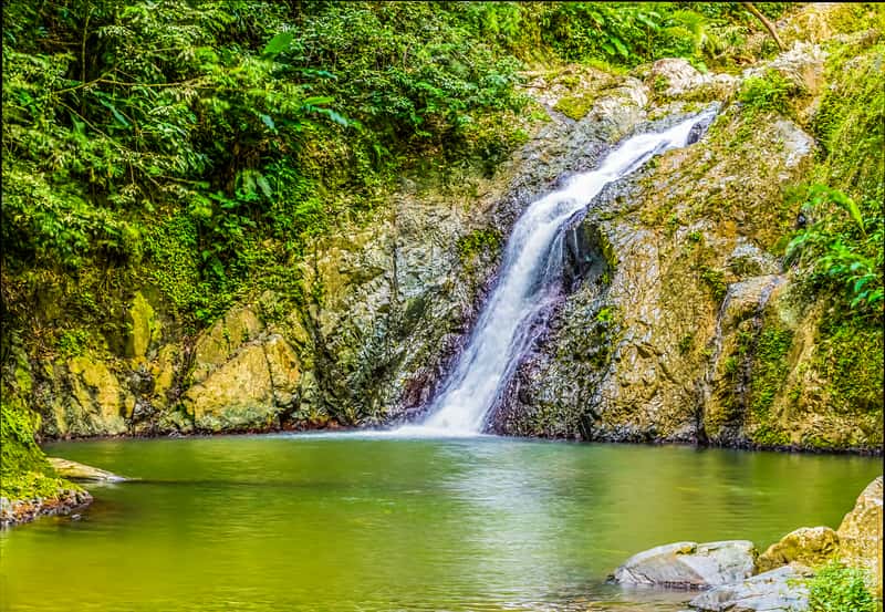
Argyle Falls on the edge of Roxborough drops 54 metres over three tiers, each with its own pool. From the car park it is about 15 minutes on foot according to Rough Guides, and you can swim in the second tier. Whether a guide is included in the fee depends on the source: Rough Guides, Lonely Planet and BBC Wildlife say yes, the airports authority lists the guide as extra. Ask at the co-operative's hut before you pay.
Argyle counts as the island's highest waterfall. Caribbean Beat, however, credits Highland Falls near Moriah with the highest single drop, and a tour operator gives about 30 metres. Both can be true, since Argyle falls in stages. The hike to Highland Falls takes about 45 minutes, according to Caribbean Beat.
Elsewhere it is shorter. Castara Waterfall, with its single pool, is ten minutes away. Twin River Falls near Pembroke has three tiers, reached along the riverbank. And near Parlatuvier a fall lies only minutes from the village, with two tiers according to Caribbean Beat, three tiers and two deep pools according to Rough Guides, which calls it Top River Falls.
Cocrico and White-tailed Sabrewing
About 210 bird species have been recorded on the Main Ridge. It is an Important Bird Area. More than a quarter of Tobago's resident birds belong to subspecies found only here, according to 10,000 Birds. The best time to look is the dry season from January to May, BBC Wildlife says.
The cocrico, or Rufous-vented Chachalaca (Ortalis ruficauda), is Tobago's national bird and appears on the coat of arms next to Trinidad's. Not everyone loves it: in early 2025 a Tobago business figure publicly called it a pest. You will see plenty of cocricos at the Grafton Caledonia Bird & Wildlife Sanctuary, from four in the afternoon in large numbers according to discovertnt. There are hummingbirds and motmots there too. The former cocoa estate has fed the birds since the hurricane of 1963.
That hurricane was Flora, and it hit Tobago on 30 September 1963. It whipped the tops off most trees, and only the largest survived in sheltered valleys. The White-tailed Sabrewing (Campylopterus ensipennis), a hummingbird, was then thought to have vanished from Tobago. It was rediscovered in 1974. Since 2005 it has been one of the first three Environmentally Sensitive Species protected by the Environmental Management Authority. Some travel sites call it endemic, but it also lives in Venezuela. On Tobago it occurs on the Main Ridge down to 100 metres.
Little Tobago, the tropicbird island
Little Tobago lies off Speyside. The boat takes about 20 minutes according to BBC Wildlife, and many visitors go across on a glass-bottom boat. On land a hillside trail climbs to the lookout. You only go with an authorised guide, and there are no facilities.
Sir William Ingram bought the island in 1908 as a bird sanctuary. In 1909 he released birds of paradise there, 47 according to Wikipedia, 24 according to Rough Guides. There have been no reliable records of them since 1963. After Ingram's death his heirs gave the island to the government in 1924. How big is it? Wikipedia says one square kilometre, Key Biodiversity Areas about 113 hectares.
Red-billed tropicbirds breed here today, along with a few pairs of White-tailed Tropicbird, Audubon's Shearwater and Brown Noddies. From December to July hundreds of red-billed tropicbirds soar around the island, according to BBC Wildlife. Frigatebirds chase them for their fish, discovertnt writes. The two sources disagree on the best months: BBC Wildlife suggests January to May, discovertnt April to September, because the sea can get rough from October to March. Under water the reefs continue off Speyside, see diving.
Peaks and a lagoon
Which peak is the highest? Unclear. German Wikipedia and Rough Guides name Pigeon Peak at 576 metres, while English Wikipedia puts the highest point of the Main Ridge at Centre Hill, at 572 metres. SummitPost gives 518, 525 or 576 metres for Pigeon Peak depending on the map and thinks the neighbouring Man of War, at 549 or 550 metres, may be higher. You climb it from Charlotteville or Speyside, about three hours, steep and poorly marked near the top. Take a guide.
Above Charlotteville rises Flagstaff Hill. At the top there is a grassy clearing with a radio mast and benches, and in the Second World War the US Army had a lookout here. A travel blog gives about 350 metres in height, a running route 320 metres of climb over a little more than three kilometres.
In the flat south-west, nature looks different. Bon Accord Lagoon near Bon Accord has been part of the Ramsar site with Buccoo Reef since 2005. Rough Guides counts more than 30 species of waterbird in its mangroves. Operators run half-day kayak trips through them, and Rough Guides recommends a licensed guide. From March, leatherback turtles come ashore at night on the beaches of the west coast; when and where to see them is on the turtles page.
Frequently asked questions about Tobago's rainforest and birds
Do you need a guide for the Gilpin Trace in Tobago?
None of the sources says a guide is required. During daylight registered guides, often former foresters, wait at the entrance to the Gilpin Trace in the Main Ridge Forest Reserve, and BBC Wildlife recommends going with a certified guide. Agree the price at the entrance.
How long is the Gilpin Trace on the Main Ridge?
Figures vary: Rough Guides gives five kilometres and about two and a half hours at a leisurely pace, BBC Wildlife 3.5 kilometres. The trail is well marked but often muddy.
Since when has Tobago's rainforest been protected?
The forest of Tobago's Main Ridge has been protected since 1776. Sources disagree on the day, 13 or 30 April; the island government has declared 30 April Main Ridge Day.
When is the best time for birdwatching in Tobago?
On Tobago's Main Ridge the dry season from January to May is the best time, and birds are most active early in the morning. For Little Tobago the sources name different months: BBC Wildlife January to May, discovertnt April to September.
Where can you see the cocrico in Tobago?
According to discovertnt you can see Tobago's national bird, the cocrico, in large numbers in the afternoon at the Grafton Caledonia Bird & Wildlife Sanctuary. The former cocoa estate has fed the birds since the hurricane of 1963.